New Zealand
South Island

New Zealand
South Island
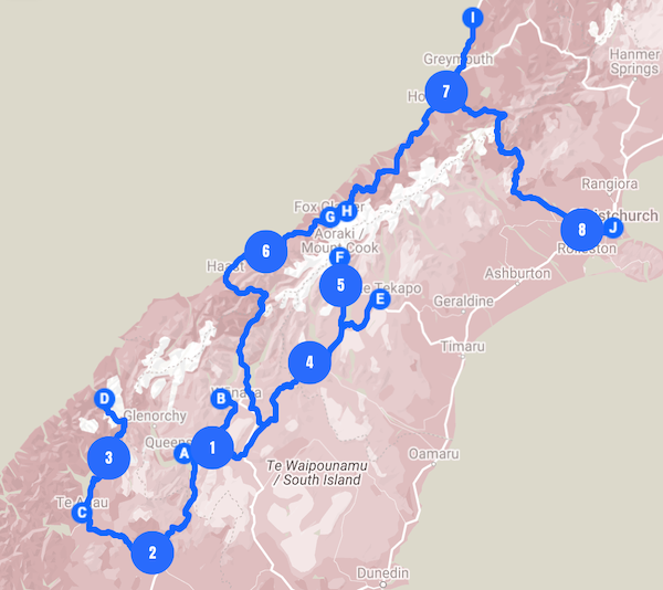
It’s always been known as one of the most beautiful places in the world, and then it became the filming location for Lord of the Rings. When I started out backpacking solo, friends suggested that New Zealand should be the place to go. Not only because of the landscape, but also the ease of getting around, and the friendliness and safety of this country. There’s so much to see that I decided to focus on South Island only for this trip, which is more about nature than culture. This 8-day itinerary is meant to be done with a rental car and covers the key highlights of the South Island.
FULL ITINERARY
- Nature
- Hiking
- Road Trip
- Traveled in October 2011
Day 1
Queenstown
Admire the beauty of the tranquil Queenstown upon arrival by going on a hike and a gondola ride | Overnight in Queenstown
9:00 am
Arrival & Check In 🅐
Pick up a rental car at the Queenstown airport which you will return at Christchurch airport at the end of this trip.
Check in to the hotel in Queenstown where you will spend the night.
- Getting to city center
The Queenstown airport is located just 15 minutes away from the city by car.
11:00 am
Skyline Queenstown
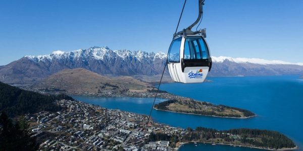
A panoramic view of Queenstown, with its blue lake surrounded by snow-capped mountains, is a must see. One of the easiest way to do this is to take a short gondola ride up to Bob’s Peak. You can also get there by hiking up the steep Tiki Trail.
An alternative as what we did is to get up early in the morning next day and go on a hot air balloon ride. It was truly an unforgettable experience. But you need to be prepared that there is no guarantee of a hot air balloon ride depending on the weather that day.
- Visiting Information
Hours: Mon – Sun 9:30am – 8:30pm.
Gondola ride only takes about 5 minutes each way but you can spend 2-4 hours at the top especially if you’d like to eat there or do the go-kart like Luge rides.
12:00 pm
Lunch
2:00 pm
Queenstown Hill Time Walk
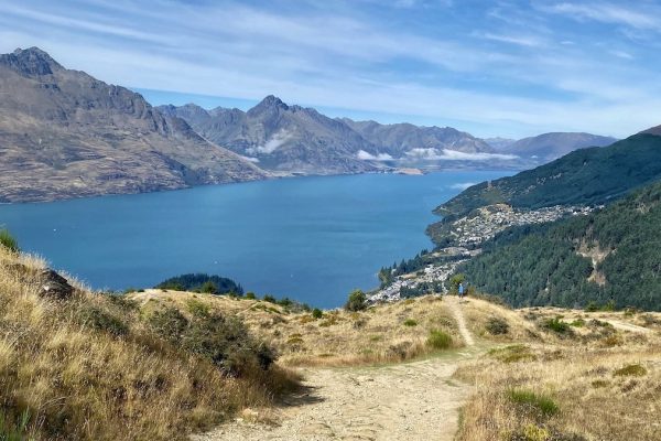
There are quite a few trails around Queenstown to get some exercise and a good view of Lake Wakatipu and the mountains. The Queenstown Hill Time Walk is a popular hike just outside the city center.
Moderate Hike
The Queenstown Hill Time Walk is a 500-metre climb through pine forest to the summit of Te Tapu-nui (mountain of intense sacredness). As you make your way along the track, you will walk by the popular ‘Basket of Dreams’ sculpture as well as six information plates that explain different epochs of Lake Wakatipu and Queenstown.
When you have completed the time walk and reach the summit, you’ll be rewarded with sweeping views of the surrounding land and some of Queenstown’s main landmarks.
9300/58 Belfast Terrace, Queenstown 9300, New Zealand
This trail is about 4km and takes 3 hours return.
6:00 pm
Dinner
Day 2
Lake Wanaka & Te Anau
Take a short detour to Lake Wanaka for a gorgeous day hike before heading south to Te Anau, the gateway to Fiordland | Overnight in Te Anau
9:00 am
Check Out & Drive to Lake Wanaka 🅑
Make a day trip to Lake Wanaka before heading south to the Fiordland. It’s about an hour drive to the Roys Peak trail car park.
10:00 am
Roys Peak Track
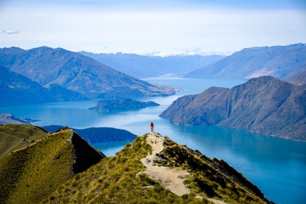
Lake Wanaka region is synonymous to hiking with gorgeous view of the snow-capped mountains and the turquoise lakes. Roys Peak Track is one of the most famous day hikes in New Zealand and a perfect spot for Instagram.
Strenuous Hike
Take in breathtaking views over Lake Wānaka, Mount Aspiring/Tititea and surrounding peaks after a steep climb through alpine meadows and tussock grasslands to the summit. You’ll climb from lake level through farmland then up into the tussock tops to the 1578 m summit. Although the trail is wide with no steps/technical difficulties, it is a very steep and strenuous uphill climb.
There is a car park next to the beginning of the track. 2$ fee at the beginning of the track. There may be limited parking at peak times. The track is closed for lambing from the 1 October – 10 November each year.
A further track branches off this track to go to the source of the Tasman River. Icebergs can usually be seen floating in the lake in summer, and in winter, the lake freezes over. The track leads through the old terminal moraines of the glacier, and you can see good examples of plant succession along the route.
Glendhu Bay 9382, New Zealand
This trail is about 16km (10 miles) and takes 5-6 hours return.
12:00 pm
Lunch
Pack a picnic lunch to eat during the hike
4:00 pm
Drive to Te Anau & Check In 🅒
It takes about 3 hours drive from Lake Wanaka to Te Anau, the gateway to Fiordland
7:00 pm
Dinner
Day 3
Milford Sound & Queenstown
Take a Milford Sound cruise and make worthy stops along the scenic Te Anau – Milford Sound Hwy, then return to Queenstown for the night | Overnight in Queenstown
8:30 am
Check Out Te Anau & Drive to Milford Sound 🅓
Take the scenic Te Anau – Milford Hwy to make a day trip to Milford Sound. I’ve often found myself more stunned at the scenery on the road than at a particular destination. The drive takes about 2 hours.
10:30 am
Milford Sound Cruise
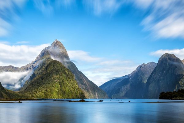
A world renowned natural wonder with towering peaks and cascading waterfalls, Milford Sound in Fiordland seems to be a must-see for every tourist in New Zealand.
When I was there years ago, there was so much hype about Fiordland that I actually spent 3 days and visited both the Milford Sound and the Doubtful Sound. Perhaps having grown up in China and seen a lot of mountains, lakes, and waterfalls like this, I wasn’t particularly awed by the experience. I don’t suggest visiting both sounds if you don’t have a lot of time, and Milford Sound was indeed the prettier one between the two and easily achievable within a day. Doubtful Sound was a lot more remote and authentic with an overnight cruise. Though with a long journey it could be boring at times. There were frequent sightings of seals in both sounds, but I was particularly excited to see penguins in Doubtful Sound.
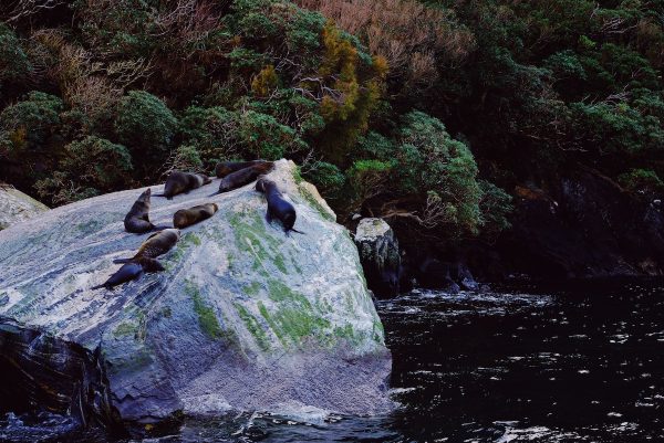
There are many cruise operators in Milford Sound. The ride takes about 2 hours.
12:30 pm
Lunch
2:00 pm
Drive to Queenstown & Check In 🅐
Return to Queenstown for the night. It takes about 3.5 hours from Milford Sound. The drive itself is a treat so take your time. Be sure to stop by and explore some incredible scenic spots.
The Chasm Walk
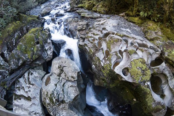
The Chasm is 10 minutes away from Milford Sound is a super easy 20-minute walk to a foot bridge overlooking a deep canyon of waterfall. The lush scenery along the trail is like out of a storybook.
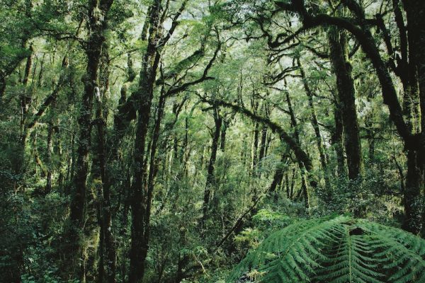
Mirror Lakes
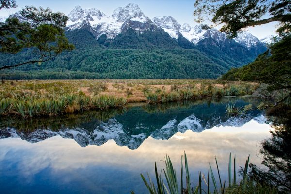
Another 40 minutes’ drive further down south from the Chasm is the Mirror Lakes. It’s a small lake about 10 minutes walk from the car park. On a calm day, this would make one hell of a photo from the South Island.
7:00 pm
Dinner
Day 4
Lake Tekapo, Lake Pukaki & Mount Cook
Drive to Mount Cook region and admire the turquoise Lake Tekapo and Lake Pukaki on the way. Do a short hike at Mt Cook Village after arrival | Overnight in Mt. Cook Village
9:00 am
Check out Queenstown 🅐 & Drive to Lake Tekapo 🅔
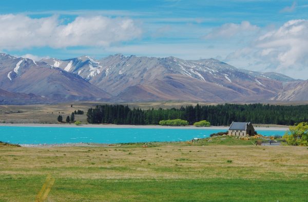
Before heading to Mount Cook National Park, take a small detour to Lake Tekapo. There’s a idyllic church right by the creamy turquoise water that makes it an ideal wedding photo spot. The drive takes about 3 hours.
12:00 pm
Lunch
2:00 pm
Drive to Lake Pukaki
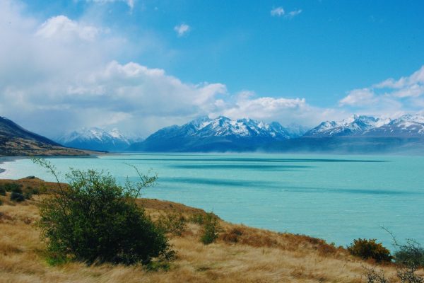
Continue driving to Mount Cook National Park. About 40 minutes from Lake Tekapo you will pass by the beautiful Lake Pukaki. Don’t forget to make a short stop here. Even though Mt Cook was hidden in clouds when I was there, it was still an awestruck sight.
2:30 pm
Drive to Mount Cook Village & Check In 🅕
Another 30 minutes you will arrive at Aoraki / Mount Cook, a small village with several accommodation options as base to explore the Mount Cook area.
4:00 pm
Tasman Glacier Walk
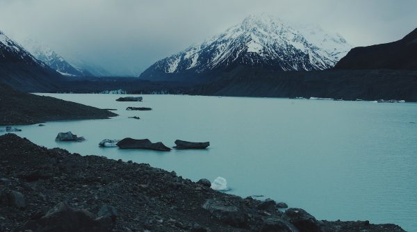
I got here by accident after I went off trail somewhere and got lost. It was 2011, almost dusk, and nobody was around. The deadly still milky green lake wrapped around by clouds, ashy glacier and silent hills was eerie to the point of frightening. I finally mustered enough courage to touch the water. It was not a dream.
Later I found out there was an easy trail to this glacier lake. Had I planned on being here, perhaps the experience would not have been so profound. Today, this is a popular short hiking trail from the Mt Cook village.
Easy Hike
At around 27 km long, the Tasman Glacier is the longest glacier in New Zealand and a relatively recent addition, having started its formation in 1974.
For a good view of the glacier, follow the path from the carpark as it meanders up past the Blue Lakes to a viewpoint on the moraine wall. From there, you can see across the valley taking in the glacier, terminal lake and surrounding mountains.
A further track branches off this track to go to the source of the Tasman River. Icebergs can usually be seen floating in the lake in summer, and in winter, the lake freezes over. The track leads through the old terminal moraines of the glacier, and you can see good examples of plant succession along the route.
From SH80 turn onto Tasman Valley Road before Aoraki/Mount Cook Village. The track begins near the carpark at the end of the road.
This trail is about 2km and takes 1 hour return.
6:00 pm
Dinner
Day 5
Mount Cook
Admire the scenery in Mt Cook region by doing a couple of day hikes | Overnight in Mt. Cook Village
8:00 am
Hooker Valley Hike
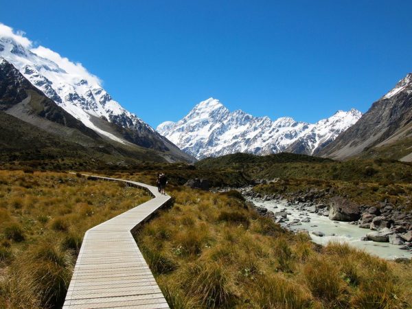
Considered one of the best day hikes in New Zealand, this easy trail crosses three swing bridges and offers spectacular view of the mountain range.
Easy Hike
Hooker Valley Track is among the most popular walking tracks in Aoraki Mount Cook National Park and the reasons why are obvious. This 11-kilometer (6.8-mile) round trip hike has non-stop mountain views and the destination is incredible. The track ends at the edge of Hooker Lake, where you can watch icebergs that were set adrift from Hooker Glacier, glide across the water below Aoraki/Mount Cook, the tallest mountain in the Southern Alps. The fun track crosses three swing bridges and several viewpoints. While this hike takes much of the day, it only has 120 meters (400 feet) of elevation change, so it is far less steep than tracks ascending into the area’s mountains.
The track starts at the White Horse Hill Campground and car park at the end of Hooker Valley Road.
This trail is about 10km return and takes 3 hours.
12:00 pm
Lunch
1:30 pm
Sealy Tarns Hike
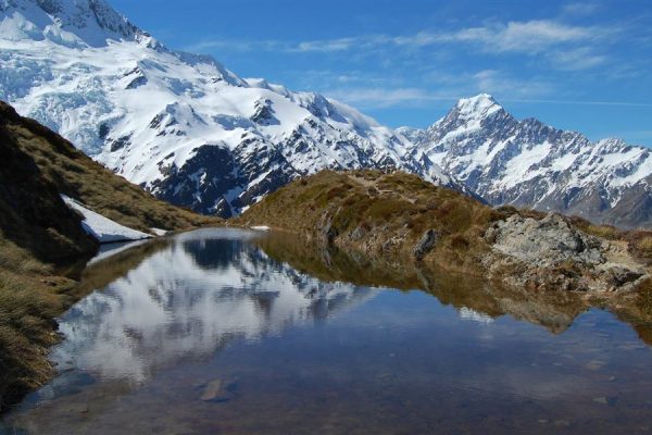
A challenging hike with 2,200 steps dubbed “stairway to heaven”. You will get a fantastic view of Mount Cook if weather is good. You can continue doing the Mueller Hut hike but it would be best done by staying overnight.
Strenuous Hike
The Sealy Tarns are located 500 meters up a steep mountainside, with mirror-like water that can reflect nearby mountains like Mount Sefton and Mount Cook. Sealy Tarns Track is not very long, but it is very steep, coming it at 5.8 kilometers round trip with 547 meters of elevation change (3.6 miles round trip with 1,795 feet of elevation change). The route uses a string of staircases to ascend to spectacular, far-reaching views over Aoraki Mount Cook National Park and the Southern Alps. A route to Mueller Hut extends above the Sealy Tarns for even loftier views. Sealy Tarns Track and Mueller Hut Route jointly make up one of the classic treks on New Zealand’s South Island.
The track branches off the Kea Point Track. The Kea Point Track starts on Terrace Road near the Aoraki/ Mount Cook National Park Visitor Centre, or at White Horse Hill Campground at the end of the Hooker Valley Road.
This trail is about 3.5 miles and takes 3-4 hours return.
6:00 pm
Dinner
Day 6
Fox Glacier
Drive to Fox Glacier for a short hike to its terminal, then settle in near Franz Josef Glacier | Overnight in Franz Josef
8:00 am
Check out Mount Cook 🅕 & Drive to Fox Glacier 🅖
It takes 5.5 hours to drive from Mt Cook Village to Fox Glacier. Take your time and admire the views along the way.
12:00 pm
Lunch
Get lunch on the road
1:30 pm
Fox Glacier Walk
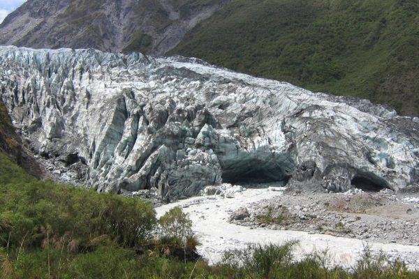
An easy one-hour return walk to the terminal of Fox Glacier, one of the two main glaciers in the New Zealand West Coast that are easily accessible.
3:00 pm
Drive to Franz Josef & Check In 🅗
Continue north for another 40 minutes to check in your accommodation in the small town of Franz Joseph. There are more options here than at Fox Glacier.
6:00 pm
Dinner
Day 7
Franz Josef Glacier, Punakaiki & Christchurch
Visit Franz Josef Glacier, then take a short detour to Punakaiki before heading out to Christchurch for the night Overnight in Christchurch
8:00 am
Franz Josef Glacier Walk 🅗
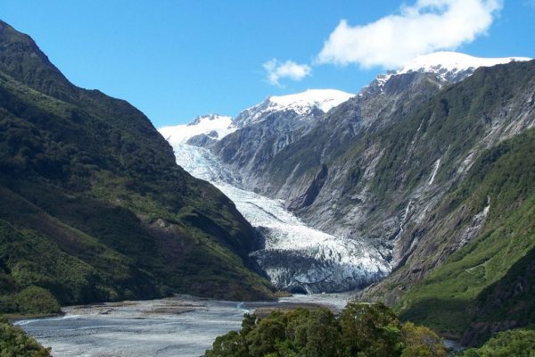
The walk to the terminal of Fraz Josef Glacier takes about 1.5 hour from the car park.
If you like, you can also do a heli-hike where a helicopter will take you to the top of the glacier followed by a guided glacier tour lasting about 2-hours walking on ice.
10:00 am
Drive to Punakaiki 🅘
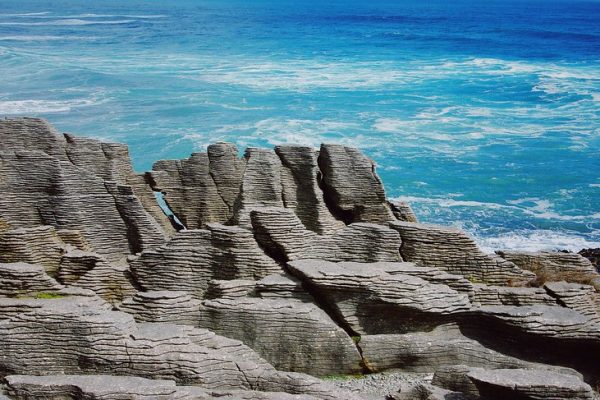
Drive along the beautiful West Coast from Franz Josef for about 3 hours to Punakaiki, known for its pancake rocks and blowholes, where columns of water shoot skyward from rocks. There’s an easy paved walk to take in the view that takes about 20 minutes.
12:00 pm
Lunch
Lunch on the road
1:30 pm
Drive to Christchurch & Check In 🅙
About 4-hour drive from Punakaiki to Christchurch.
6:00 pm
Dinner
Day 8
Christchurch
Explore Christchurch before departure
9:00 am
Christchurch City

I was in Christchurch right after the 2011 earthquake. Much of the city was in shambles. It was very quiet. Drinking water was scarce. It was a heartbreaking sight but also inspirational to see how quickly and united the people have strived to get back to their feet. Today, there is a Quake City museum in the city that tells the story of what happened.
Other notable places to visit in the city are the Reagent Street and the Botanic Gardens.
12:00 pm
Lunch
2:00 pm
Akaroa
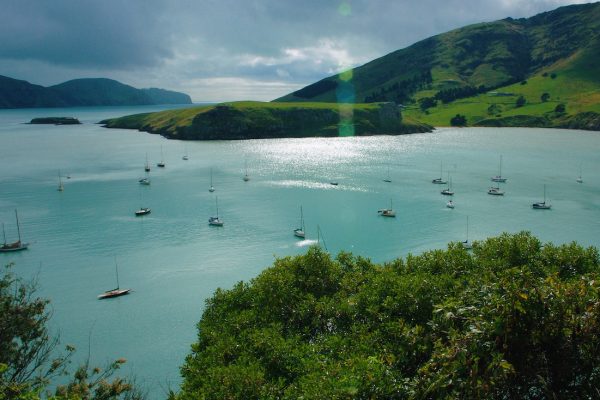
If you have time, drive up the dangerously narrow mountain roads to get a view of Akaroa. It’s an hour away from Christchurch and a very pretty harbor.
